CLIMATE ACTION PLANNING
TOPSHAM, MAINE

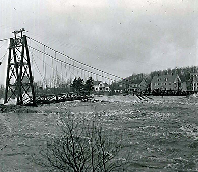
FB Environmental completed a Baseline Climate Vulnerability Assessment as part of the Town of Topsham, Maine's Climate Action Plan update. The assessment identified risks from flooding, extreme precipitation, sea level rise, and rising temperatures and, along with the Town’s updated Greenhouse Gas Inventory, informed future sustainability and resilience planning. We analyzed how climate change may affect infrastructure, public systems, and community assets and identified locations across town where roads, bridges, neighborhoods, and utilities are most vulnerable.
The project combined spatial data analysis, document review, and local input to understand existing challenges and emerging climate hazards. Findings highlight vulnerabilities to flooding along key road corridors, stormwater and heat island concerns in developed areas, groundwater rise in neighborhoods, and drought risks in rural areas relying on private wells.
This assessment provides the Town with a foundation for climate action planning by identifying priority areas of concern and supporting future resilience strategies, infrastructure investments, and long-term adaptation planning.